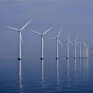
Windfarm Siting
Objectives
The wind farm siting Challenge aimed to:
- characterize the suitability of marine sites for wind farm development in particular:
– on the border between Spain and France
– on the border between France and Italy
– on a French offshore wind turbine test site near Marseille
- evaluate the accuracy and the suitability of the available data and quantify the associated uncertainties via statistical analysis
This Challenge contributed in parallel to the data collection framework for checkpoint information and report assessment resulted in the literature survey and data adequacy reports.
Methodology
Database building
Use of the 10-year database made by the Atmospheric Modeling and Weather Forecasting Group of the University of Athens (under the framework of the FP-7 European project MARINA PLATFORM).
Database analysis
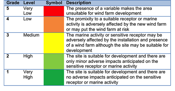
The analysis of the database included spatial and in situ statistical analysis. More precisely, the suitability of areas for wind park installation had been quantified by taking into consideration multiple criteria (natural resources and constraints) and utilizing a five scale grading.
Natural resources
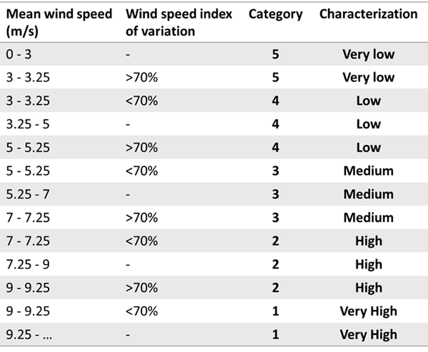
The site availability was performed by using the mean wind speed and the wind speed index of variation (10 m), which are the most critical parameters for the estimation of wind power potential. These produced the five scale suitability index expressed in the next Table.
Constraints
In addition, potential constraints set by anthropogenic or other activities were included in a second phase.
Data Sources
- High resolution meteorological analyses for various characteristics (winds, air temperature, etc.) from past EU FP7 projects (MARINA, etc.);
- High resolution model and satellite altimetry wave characteristics from past (i.e., pre [give data of checkpoint contract end]) EU FP7 projects;
- Shipping lanes/traffic from AIS data made available by EMSA;
- Bathymetry (numerical values and maps) from the EMODnet thematic portal;
- Seafloor geology from the EMODnet thematic portal;
- Benthic ecosystem structure from the EMODnet thematic portal;
- Electric grid position from network operators and public bodies and from the EMODNET Human Activities thematic portal;
- Bird migratory patterns (from the literature).
Targeted Products
Final Challenge Report: MedSea Checkpoint Challenge 1 (Wind Farm Siting): Description of Targeted Products, the methodology and the expert evaluation of fitness for purpose
How to Cite: “Kallos, G., Galanis, G., Patlakas, P., Kalogeri, C., Filipot, J.-F., Duarte, R., & Simoncelli, S. (2017). EMODnet MedSea CheckPoint Challenge 1 (Wind Farm Siting) Report. European Marine Observation and Data Network. https://doi.org/10.25423/cmcc/
Team Involved
Atmospheric Modeling and Weather Forecasting Group, National and Kapodistrian University of Athens (NKUA), Greece
Institut Français de Recherche pour l’Exploitation de la Mer (IFREMER), France
France Energies Matines (FEM), France