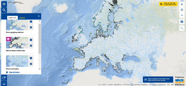
Map of the Week – World Wetlands Day, Rivers and Marine Natura 2000 sites

Did you know that 2 February is World Wetlands Day ? Wetlands are land areas that are saturated or flooded with water either permanently or seasonally. They include freshwater wetlands (rivers, lakes, pools, flood plains, peatlands, marshes, swamps), saltwater wetlands (estuaries, mudflats, saltwater marshes, mangroves, lagoons, coral reefs, shellfish reefs) and human-made wetlands (fishponds, rice paddies, reservoirs, saltpans). The 2024 theme for World Wetland Day is ‘Wetlands and Human Wellbeing’. It highlights that the benefits wetlands provide help sustain life and are central to human wellbeing. This include many aspects including water, food, livelihoods, climate, culture and biodiversity. Our health depends on well-functioning ecosystems, including wetlands. Yet, wetlands are the Earth’s most threatened ecosystem. Human activities and climate change are causing degradation of wetlands. [1]
Conservation and restoration of wetlands are thus key to sustainable development and the One Health integrated, unifying approach that aims to sustainably balance and optimise the health of people, animals and ecosystems. [1] Initiatives to protect and restore wetlands notably include the Convention on Wetlands , the UN Decade on Ecosystem Restoration (2021-2030) and the European Habitats Directive. In Europe, the Birds and Habitats Directives form the cornerstones of the biodiversity policy. Together, the two directives have led to the development of the Natura 2000 network of protected areas. [2]
Wish to know more?
- Read the World Wetlands Day PowerPoint presentation ;
- Watch the Euronews’ Ocean episode on wetlands;
- Explore the Map of the Week which is composed of three map layers showing the main European rivers and lakes (click on the rivers to see their names), the river gauging stations (click on the stations to see information about the stations and access river flow rate data from the station) and the marine Natura 2000 sites (click on the sites to learn more about them). Zoom in on the land-sea interface to see estuaries.
The data in this map are provided by EMODnet and the Joint Research Center (JRC) .
[1] World Wetlands Day 2024 Materials – PowerPoint Presentation: https://www.worldwetlandsday.org/materials
[2] https://environment.ec.europa.eu/topics/nature-and-biodiversity/habitats-directive_en
